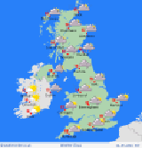
 Staying cloudy north and east, some light afternoon rain here; best
of bright/sun spells southwest areas. Good morning, The unrelenting
high pressure and northeasterly winds remain unrelenting, meaning
its another cloudy day in the north and east. Today is different through,
because some weak cold fronts will be arriving into northeastern areas,
brining some scattered patchy rain in the afternoon; dry elsewhere.
A widespread frost at dawn in Scotland with some early fog in the
northwest. Likely frosty too in upland areas of England and Wales.
As with previous days, the best chance for sunny breaks are in western
areas, mostly in the lee of mountains; southwest Scotland looks to
be in for a sunnier day. Highs of 2 to 5C in Scotland and Ireland,
nearer 3 to 6C in England though eastern areas will be nearer 7C.
Conditions change little overnight; cool east-northeasterly winds
blow across England, Wales, and Ireland with mostly cloudy skies.
Some clearer skies in Scotla
nd as high pressure settles more definitely here, allowing substantial
overnight cooling and more fog forming. Lows at 0C north, 3 or 4C
south, locally warmer southeast England.
more...
------
back...
Main Menu
